Cartodyne is a highly skilled Geospatial and IT services firm that leverages extensive hands-on industry practice with modern tools to deliver solutions for business as well as local government organizations & municipalities.
“ChatGPT, a version of OpenAI’s GPT-3.5 [family]… gained more than 100m users in its first two months, and is now estimated to produce a volume of text every 14 days that is equivalent to all the printed works of humanity.” — Dr. Thompson, Feb/2023, cited in report by the National Bureau of Economic Research (Scholes, Bernanke, MIT)
Ready or not, the age of an augmented workforce is upon us. Companies are racing to invest in the latest iteration of generative AI technologies such as OpenAI‘s ChatGPT. ChatGPT is the future for technology workers, enabling them to work smarter and more efficiently every day. OpenAI recently made their APIs available for use in your own solutions and applications.
We were asked to do a few training sessions on ChatGPT and how every day workers can leverage this technology in daily work activities. If you are brand new to this topic, here is a primer of what ChatGPT and its underlying large language model works called “GPT-3 – How can it help?”
More recently, we did a live demo of providing prompts to ChatGPT for daily work tasks. The presentation below includes slides notes with the sample prompts for revising text, translating text from English to Spanish, extracting email addresses from a messy text string, MS Excel formula creation and definition description in natural language, as well a “Act As” prompt patterns for the AI to behave as a Technical Documentation Writer for your custom solution as well an Esri Solutions Provider delivering assistance on upcoming upgrade.
Finally, the second presentation includes examples of how to use Python with OpenAI API calls. With remarkably few lines of code, we cover the GPT-4 API Request, with which developers can send requests to the GPT-4 API endpoint using Python and receive text-based responses. We include a sample API call for the Whisper AI for audio translation as well as the DALL-E API for image generation.
Do you have any workflow processes that were previously impossible or uneconomical to automate? Generative AI solutions might be able to solve them. Schedule a call with us to discuss your project.
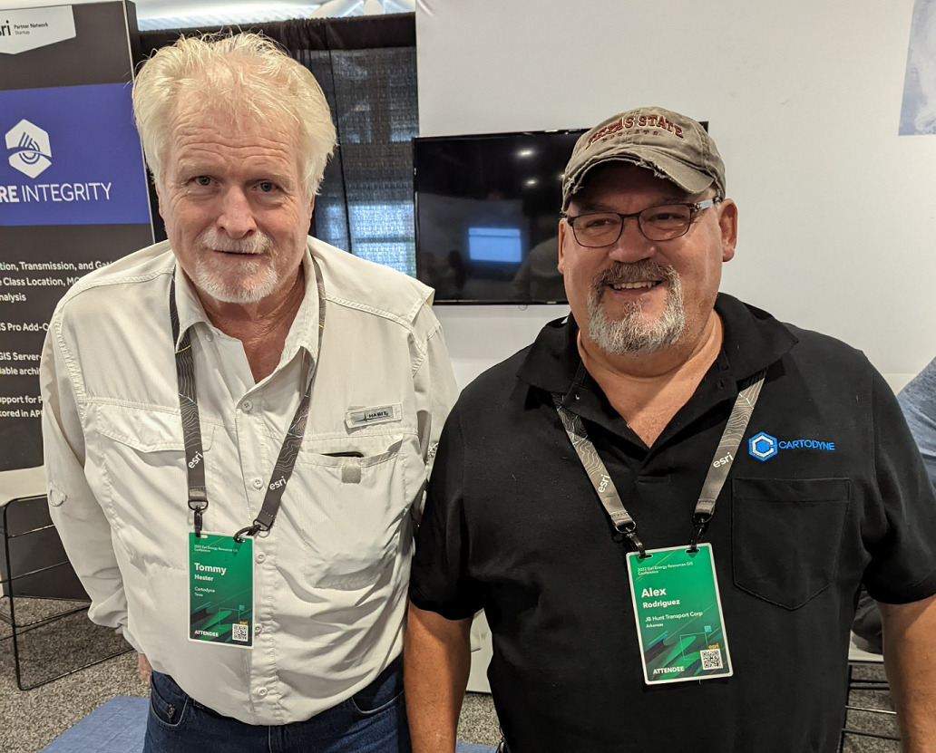
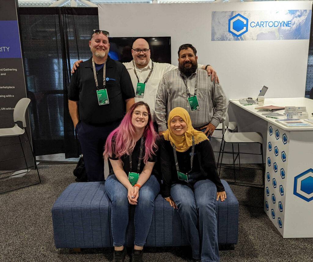
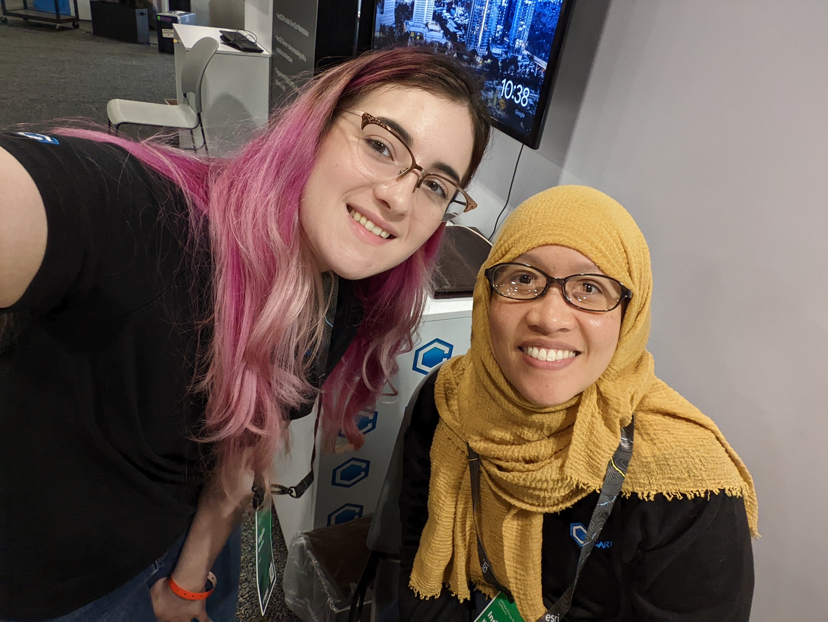
Cartodyne exhibited and presented at the Esri Energy Resources GIS Conference at the George R. Brown convention center in Houston, Texas. Being surrounded by colleagues and clients excited about spatial technologies and solutions in-person for the first time in a few years was a welcomed experience. Esri did a great job putting on the event and supporting it.
Tom and AlexLloyd, Jason, Mike, Kaylin, & CiciKaylin and CiciTeam Cartodyne
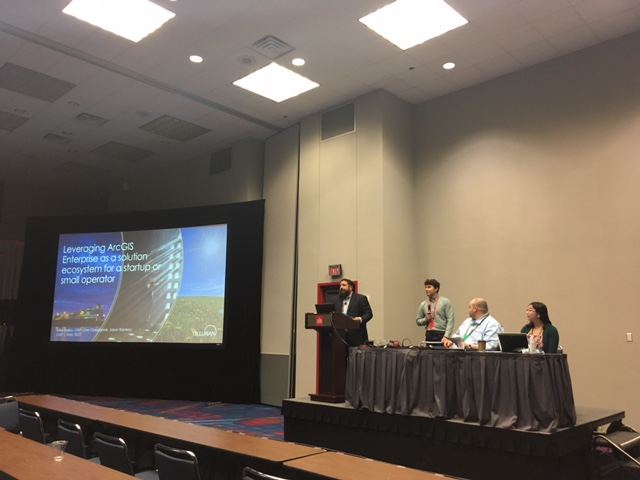
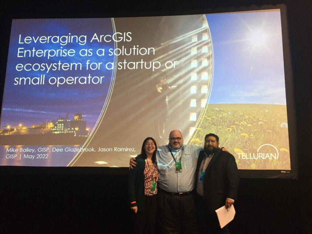
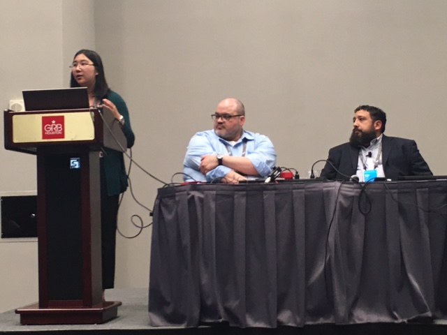
This year, in collaboration with the excellent technology team at Tellurian Inc., we also shared a presentation discussing some of our work entitled “Leveraging ArcGIS Enterprise as a Solution Ecosystem for a Startup or Small Operator”. From startup to operations within the Upstream team, we were fortunate to build the enterprise system. Shown below is an abstract for our presentation.
Founded in 2016, Tellurian closed an agreement in November 2017 to purchase natural gas-producing assets and undeveloped acreage in Northern Louisiana. As part of that venture, the Tellurian Upstream & IT team invested in a single machine base implementation of ArcGIS Enterprise in Azure. Though initially deployed to provide a unified upstream view of operational data, the web GIS platform continues to be a go-to resource to provide out-of-the-box spatial solutions for emergent business needs across the enterprise. This presentation will cover some of those solutions, what business use cases precipitated the requests, and how readily available ArcGIS Enterprise functionality can be utilized to deliver value to Tellurian and other similarly sized operators.
“Leveraging ArcGIS Enterprise as a Solution Ecosystem for a Startup or Small Operator.” – 2022 Esri Energy Resources GIS Conference Proceedings
Mike, J. Bires, Jason, & DeeWhat a team!Dee dropping knowledgePresentation Day
Thanks to everyone who stopped by to say hello or who shared their exciting projects. We look forward to seeing everyone again next year!
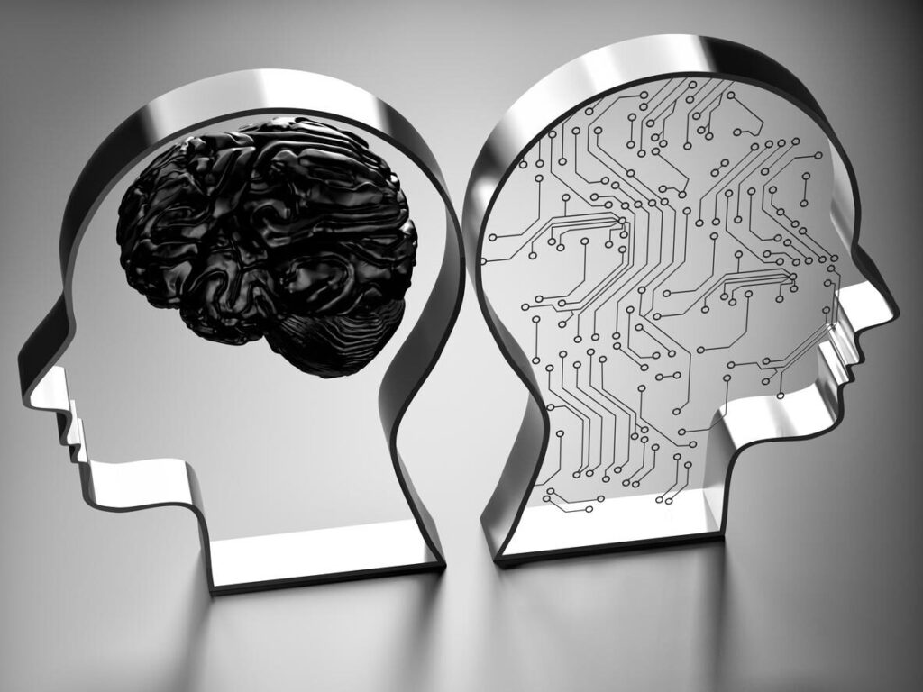
In the ever-evolving landscape of technology, generative artificial intelligence (AI) stands out as a transformative force. As industries across the board embrace the potential of AI, organizations from municipalities to oil and gas companies are discovering how this cutting-edge technology can address their unique challenges and drive innovation.
Generative AI, a subset of artificial intelligence that involves machines creating new content, has been making waves in diverse sectors. In today’s post, we delve into how generative AI is reshaping the way municipalities operate and how it’s bringing about groundbreaking changes in the oil and gas industry.
The Evolving Landscape of Municipalities
Municipalities face a myriad of challenges, from urban planning to citizen services. Generative AI offers a promising solution by optimizing city operations and enhancing infrastructure planning. By analyzing vast datasets, generative AI algorithms can predict traffic patterns, optimize public transportation routes, and even contribute to effective disaster response planning. The result is a more streamlined and efficient urban environment that improves the quality of life for residents.
Innovations in Oil and Gas with Generative AI
The oil and gas industry, known for its complex processes, is undergoing a revolution with the integration of generative AI. Reservoir management, exploration, and production optimization are areas where AI algorithms can make a significant impact. By analyzing geological data and predicting potential reserves, generative AI assists companies in making informed decisions, reducing environmental impact, and enhancing overall safety protocols.
Real-world Applications
Real-world applications of generative AI in municipalities and oil and gas companies are already yielding impressive results. In Barcelona, Spain, for example, generative AI is being used to optimize waste collection routes, leading to a reduction in fuel consumption and emissions. In the oil and gas sector, companies like ExxonMobil are employing AI-driven technologies to improve drilling efficiency and reduce operational costs.
Addressing Concerns and Challenges
As with any emerging technology, concerns arise regarding data privacy, ethics, and potential job displacement. It is crucial for companies and municipalities to address these challenges responsibly. Striking a balance between innovation and ethical considerations ensures that generative AI is implemented in a way that benefits both industries and society as a whole.
Future Outlook
Looking ahead, the future of generative AI holds even more promise. Ongoing research and developments indicate that the technology will continue to evolve, bringing about new and improved applications for municipalities and oil and gas companies. As AI becomes more sophisticated, its ability to solve complex problems and drive innovation will only increase.
Conclusion
The integration of generative AI is reshaping the landscapes of municipalities and oil and gas companies. From optimizing city operations to revolutionizing resource extraction processes, the potential benefits are vast. As these industries continue to embrace AI, it is essential to stay informed about the latest developments and explore how your company can leverage generative AI for a sustainable and efficient future. Stay ahead of the curve by exploring how generative AI can benefit your organizations! Learn more AI implementation, and discover the transformative power of generative artificial intelligence.
The last year unfolded as a pivotal moment in the AI landscape, featuring major releases from tech giants such as Google and emerging players like Anthropic. However, stealing the spotlight was OpenAI’s GPT-4, a multimodal large language model currently accessible only to developers. This post takes a dive into the creative and practical applications of GPT-4, showcasing its versatility and transformative influence across various domains.
Hustling with GPT-4 Brand designer Jackson Greathouse Fall conducted a unique experiment, challenging GPT-4 to generate income with a mere $100 budget. The AI’s suggestion of an eco-friendly affiliate marketing site became a social media sensation, illustrating GPT-4’s potential as a valuable brainstorming tool, even in a publicity stunt.
Productivity in the Workplace Major tech players, including Microsoft and Google, are seamlessly integrating GPT-4 into office suites to enhance productivity. Tasks ranging from summarizing documents, aiding presentations, drafting emails, proofreading texts, to generating images are becoming streamlined. This trend underscores the growing integration of AI into everyday work experiences.
Revolutionizing Healthcare Documentation Ambience Health, a startup funded by OpenAI, leverages GPT-4 to generate medical documentation from provider-patient conversations. Co-founders Nikhil Buduma and Mike Ng highlight the AI’s potential in alleviating doctors’ workloads by tackling tedious tasks like data entry. However, concerns about GPT-4’s accuracy in crucial healthcare domains are also raised.
Efficient Code Generation Princeton’s Computer Science Professor Arvind Narayanan attests to GPT-4’s efficiency in generating code, emphasizing its time-saving benefits and psychological advantages. A demonstration by OpenAI co-founder Greg Brockman, where GPT-4 created a website from a simple napkin sketch, showcases the model’s prowess in automating mundane yet time-consuming tasks.
Co-Writing Books with GPT-4 Reid Hoffman, LinkedIn co-founder and OpenAI investor, unveils the collaborative potential of GPT-4 in co-authoring “Impromptu: Amplifying Our Humanity through AI.” Hoffman explores the various ways the AI model can be applied in education, the arts, the justice system, journalism, and more. The article includes insights from Hoffman’s interactions with GPT-4.
While GPT-4 emerges as a powerful assistive technology with the potential to revolutionize various industries, caution prevails. OpenAI acknowledges safety risks, emphasizing the need for human experts to guide and correct the model’s outputs. The article urges responsible usage, emphasizing that navigating the uncharted territory of advanced AI models requires vigilance, not blind enthusiasm.
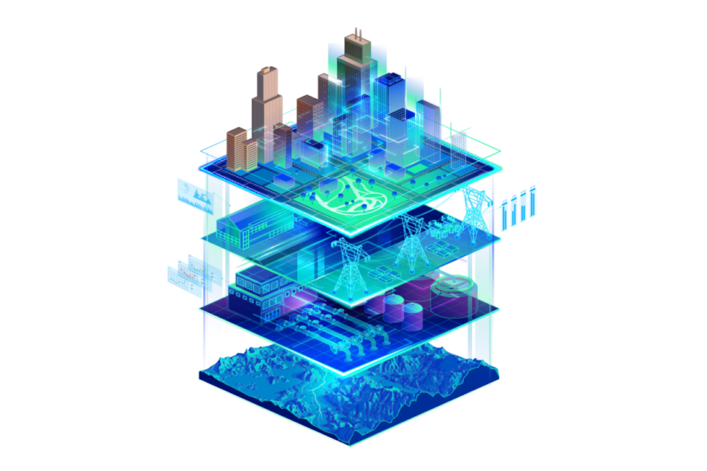
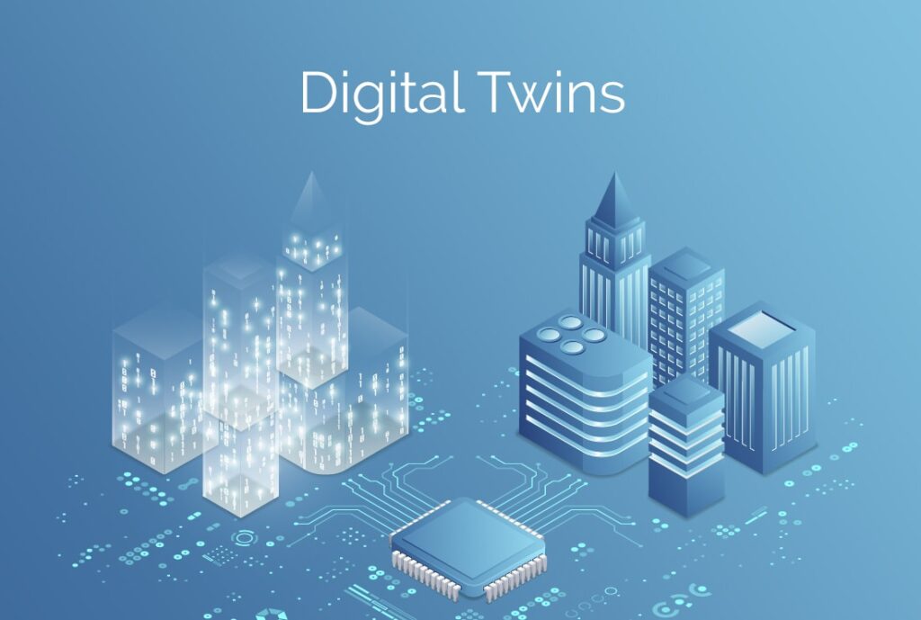
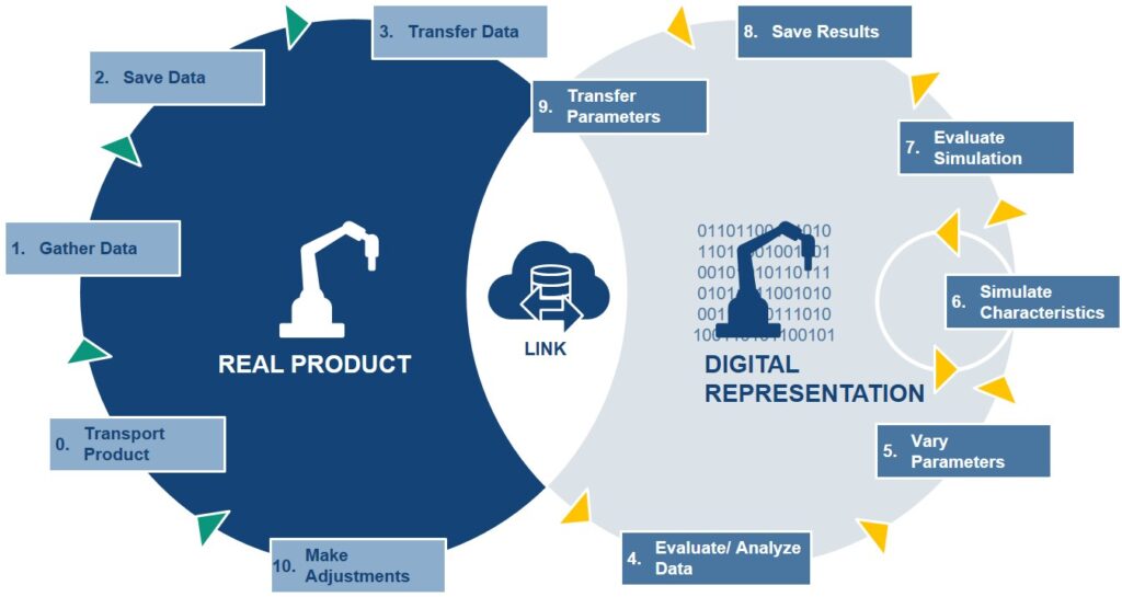
In the ever-evolving landscape of digital innovation, the concept of Digital Twins has emerged as a transformative force, reshaping how we perceive and interact with the real world. Digital Twins, virtual replicas of physical objects and systems, have found a robust foundation in ArcGIS, a cutting-edge geospatial technology developed by Esri. ArcGIS is not merely a tool; it’s a cornerstone empowering the creation of intricate and interactive digital twins in fields as diverse as architecture, engineering, and construction.
Digital Twins, in their essence, serve as comprehensive virtual representations of the physical world, incorporating objects, processes, relationships, and behaviors. They offer a unique perspective, enabling accurate historical documentation, real-time performance monitoring, and the simulation of future states. When integrated with Geographic Information System (GIS) data, these digital twins become immensely powerful, facilitating a deeper understanding of the physical world and its complexities.
Unveiling the Potential of Digital Twins:
Digital Twins serve a myriad of purposes, addressing critical challenges faced by industries today. The first among these is the preservation of historical records. Digital Twins, when crafted with precision, become archives, capturing specific moments in time for assets or systems. This historical context becomes invaluable for legal and operational purposes, aiding in decision-making processes.
Operational performance monitoring represents another significant area where Digital Twins shine. By providing real-time, interactive 3D representations of assets, digital twins transform into dynamic dashboards. These dashboards, often linked to live feeds and enterprise systems, empower users to monitor the actual system’s performance with unparalleled depth and accuracy.
Furthermore, Digital Twins play a pivotal role in testing and predicting future performance. Whether in the automotive industry, where aerodynamics are scrutinized, or in urban planning, where the impact of new constructions is simulated, digital twins provide a platform to explore scenarios and optimize outcomes while minimizing costs.
The Integral Role of GIS in Digital Twins:
Crucially, Geographic Information System (GIS) technology forms the backbone of digital twins. GIS data, overlaid on 3D models, facilitates complex analyses by providing a common key—’location.’ This simple yet fundamental element enables the integration of diverse data models and sets, paving the way for sophisticated simulations and analyses.
Esri’s ArcGIS has undergone substantial advancements, evolving into an ideal technology to merge disparate data sets seamlessly. It enables the creation of federated data systems, interactive maps, and dashboards that facilitate communication, observation, and analysis of complex systems, including entire cities.
GIS also lends itself to numerous simulations, ranging from shadow impacts of structures to airflow analyses in urban centers. With tools like the ArcGIS Maps SDK for Unity and Unreal Engine, GIS content can even be integrated into game engines, expanding its potential applications further.
Considerations and Success Factors:
Embarking on a digital twin project requires careful consideration and planning. Several factors influence the scope and success of such endeavors. Time scale, stakeholder diversity, system complexity, data ownership, and data security all play pivotal roles in determining the project’s parameters.
Successful digital twin projects hinge on well-defined outputs, a design thinking approach that involves stakeholders, clear requirements for information architecture, adherence to open data standards and APIs, and standardized authentication and licensing protocols. These elements collectively shape the digital twin’s effectiveness and usability, ensuring it aligns seamlessly with the intended goals.
The Future of Digital Twins with ArcGIS:
Today, ArcGIS empowers users to blend reality capture, 3D modeling, planimetric data, and real-time feeds into dynamic, interactive experiences. ArcGIS facilitates the creation of geospatial digital twins, allowing exploration on various platforms, from mobile devices and web browsers to desktop applications.
Several notable projects exemplify the transformative potential of ArcGIS-powered digital twins. Amsterdam Airport Schiphol, HNTB, Hartsfield-Jackson Atlanta International Airport, and Hazen and Sawyer have leveraged ArcGIS to craft innovative, data-rich digital twins, enhancing their operations and decision-making processes.
Esri’s commitment to advancing the field of digital twins is unwavering. Through investments in reality capture, Building Information Model (BIM) integration, IoT, and other cutting-edge technologies, Esri ensures that ArcGIS remains at the forefront of the digital twin revolution, enabling users to create the next generation of immersive and insightful digital twins.
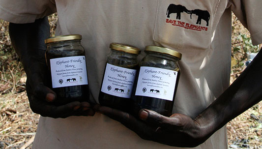
In the heart of Africa, where humans and elephants share the land, a unique solution has emerged to protect both farmers’ livelihoods and one of the continent’s most majestic creatures. The Elephants and Bees Project, an initiative by Kenya-based Save the Elephants, demonstrates the extraordinary impact of geospatial technology in addressing human-elephant conflicts while fostering coexistence and understanding between communities and wildlife.
The Beehive Fences: A Nature-Based Solution
An ancient African folktale revealed elephants’ fear of honeybees, a fear that researchers like Lucy King have utilized to safeguard these magnificent animals. By playing recordings of swarming African honeybees near elephant herds, King and her team observed elephants swiftly retreating, laying the foundation for a creative solution. The answer came in the form of beehive fences, crafted from wire and treated poles with beehives suspended between them. When elephants approach these fences, the bees emerge, creating a natural deterrent that protects farmlands.
Transformative Impact of Geospatial Technology
Save the Elephants, in collaboration with GIS officers, embraced geospatial technology to monitor elephant movements and assess the effectiveness of beehive fences. Initially tracking elephant data manually, they transitioned to advanced tools like ArcGIS Survey123, significantly reducing the time spent on data collection. Real-time data analysis and visualization through ArcGIS Dashboards facilitated informed decision-making, enabling the project to expand its reach and protect more farms.
A Comprehensive Approach to Conservation
With time saved through automation, researchers could focus on multifaceted approaches. Conservation agriculture methods were imparted to farmers, and initiatives like a women’s enterprise center and “elephant-friendly” honey packaging were developed. Moreover, the team created a Human-Elephant Coexistence Toolbox, a repository of strategies drawn from experiences across Africa. Remote sensing technology aided in understanding elephant behavior and their dietary preferences, opening new avenues for research and conservation efforts.
Empowering Africa’s Biodiversity
The amalgamation of geospatial technology and conservation efforts has empowered communities, governments, and stakeholders. By visualizing data, GIS technology enables a deeper comprehension of the interconnected systems at play. It not only helps in safeguarding elephants but also contributes to the preservation of Africa’s rich biodiversity. Through this innovative approach, Africa’s elephants are not merely protected; they are being understood, respected, and celebrated as a vital component of the continent’s natural heritage.
Conclusion
The story of elephants and bees in Africa illustrates the transformative power of geospatial technology in conservation. By fostering harmony between humans and elephants, this initiative showcases the profound impact that innovative solutions, coupled with advanced technology, can have on preserving biodiversity and ensuring the coexistence of all species. As we continue to harness the potential of geospatial tools, we move one step closer to a future where wildlife and communities thrive together, embodying the essence of sustainable cohabitation.
Tufts University’s Master of Science in Conservation Medicine (MCM) program at the Cummings School of Veterinary Medicine is revolutionizing the way students approach conservation challenges. While preparing veterinarians, physicians, ecologists, and conservation professionals to tackle urgent global issues, the program has incorporated a unique requirement: a GIS (Geographic Information Systems) course.
The MCM program, dedicated to addressing critical planetary issues such as habitat conservation, emerging diseases, biodiversity loss, and climate change, recognizes that these challenges are inherently spatial in nature. Carolyn Talmadge, Data Lab services manager and course director, believes that GIS and spatial analysis skills are essential for understanding the scope of these problems.
Initially, the program offered only workshops and guest lectures on GIS. However, Talmadge, a GIS specialist at Tufts, recognized the need for a comprehensive GIS course tailored to conservation medicine. In 2016, she introduced the semester-long “GIS for Conservation Medicine” course, which has since become one of the program’s most popular and highly-rated offerings.
Empowering Future Conservation Leaders
Talmadge’s teaching philosophy centers on inspiring students to see GIS as a powerful tool for solving real-world conservation problems. “My goal for the class is to first provide the motivation for learning GIS before teaching the skill itself,” she states, emphasizing that GIS can be both accessible and enjoyable. Under her guidance, students have found positions with prestigious organizations such as the Smithsonian Institution, MIT, Harvard University, the World Bank Group, and the United Nations, among others.
Former colleague Madeline Wrable, now a solutions engineer for imagery and remote sensing at Esri, praised Talmadge’s dedication to her students’ success. Wrable attests that Talmadge “teaches GIS like someone who has found their passion in life” and offers unwavering support throughout their learning journeys.
Building a Comprehensive Curriculum
Recognizing that students in the MCM program possess varying levels of technical expertise, Talmadge tailors her course to cater to diverse backgrounds. She uses the One Health approach, emphasizing the interconnectedness of people, animals, plants, and the environment, to demonstrate the broad applications of GIS in environmental and public health.
Talmadge believes in making GIS accessible through hands-on activities that reinforce concepts learned in lectures. These activities cover various scales, addressing challenges from local neighborhoods to global issues. Using real-case scenarios and datasets, students engage in purposeful learning, understanding how GIS can be applied to their research and career interests.
Talmadge’s course also places a strong emphasis on cartography, design, and effective communication of spatial data. Students use tools like ArcGIS Online and ArcGIS Pro to create high-quality maps, manage databases, and perform spatial analysis. One standout assignment involves collecting field data using ArcGIS Survey123, enabling students to explore topics like wildlife sightings and habitat degradation.
The culmination of the course is a GIS analysis project where students choose a topic and create informative posters. Many of these posters have garnered recognition at the Esri User Conference Map Gallery competition, further highlighting the practical skills acquired in the course.
Looking to the Future
Talmadge is continuously looking for ways to enhance her course and the integration of GIS in conservation efforts. She believes that incorporating GPS data collection and drone technologies will expand the application of GIS in conservation. As GIS becomes more integrated into the practice of conservation, it holds the promise of making the results of field studies accessible to the public and fostering interdisciplinary collaboration.
In summary, Tufts University’s MCM program is not only shaping the future of conservation medicine but also nurturing a new generation of conservation leaders armed with GIS skills. Carolyn Talmadge’s dedication to inspiring and equipping her students with GIS expertise is creating a ripple effect in the field of conservation, where spatial analysis and data-driven decision-making are becoming increasingly indispensable. As GIS continues to evolve, so does the potential for innovative solutions to the pressing challenges our planet faces.
In a historic move, 193 nations came together in March 2023 to sign the United Nations (UN) High Seas Treaty, a landmark agreement that aims to protect the ocean and reverse biodiversity loss. The treaty, the first of its kind, establishes a framework for safeguarding the high seas, which make up two-thirds of the world’s ocean and fall beyond national boundaries and governance. The signing of this treaty signifies a growing recognition of the ocean’s importance and the need for its preservation.
UN Secretary-General António Guterres described the treaty as “crucial for addressing the triple threats of climate change, biodiversity loss, and pollution.” It is a significant step toward tackling these global challenges and promoting sustainable development. The ocean plays a vital role in mitigating climate change by generating 50 percent of the world’s oxygen, absorbing 25 percent of carbon dioxide emissions, and capturing 90 percent of excess heat caused by those emissions. Furthermore, it supports marine life and provides nearly 10 million tons of fish annually to feed a growing population.
Despite its immense value, the ocean remains largely unexplored and poorly understood. Until recently, only 6 percent of the Earth’s seafloor had been mapped to a comparable degree as the surface of the Earth, moon, or Mars. This lack of knowledge hampers efforts to protect marine ecosystems effectively. Approximately 91 percent of species in the ocean remain unclassified, highlighting the urgent need for comprehensive research and conservation efforts.
The ocean faces numerous threats, including rising temperatures, pollution, overfishing, and seabed mining. Over the past 30 years, ocean temperatures have increased due to rising concentrations of greenhouse gases, leading to sea-level rise, coastal land loss, and coastal flooding. The acidification of the ocean caused by higher carbon dioxide levels adversely affects marine species and ecosystems. Pollution from debris, including microplastics and abandoned fishing gear, continues to plague the ocean. Unsustainable fishing practices and commercial mining of seabed minerals further endanger marine life and the health of the ocean.
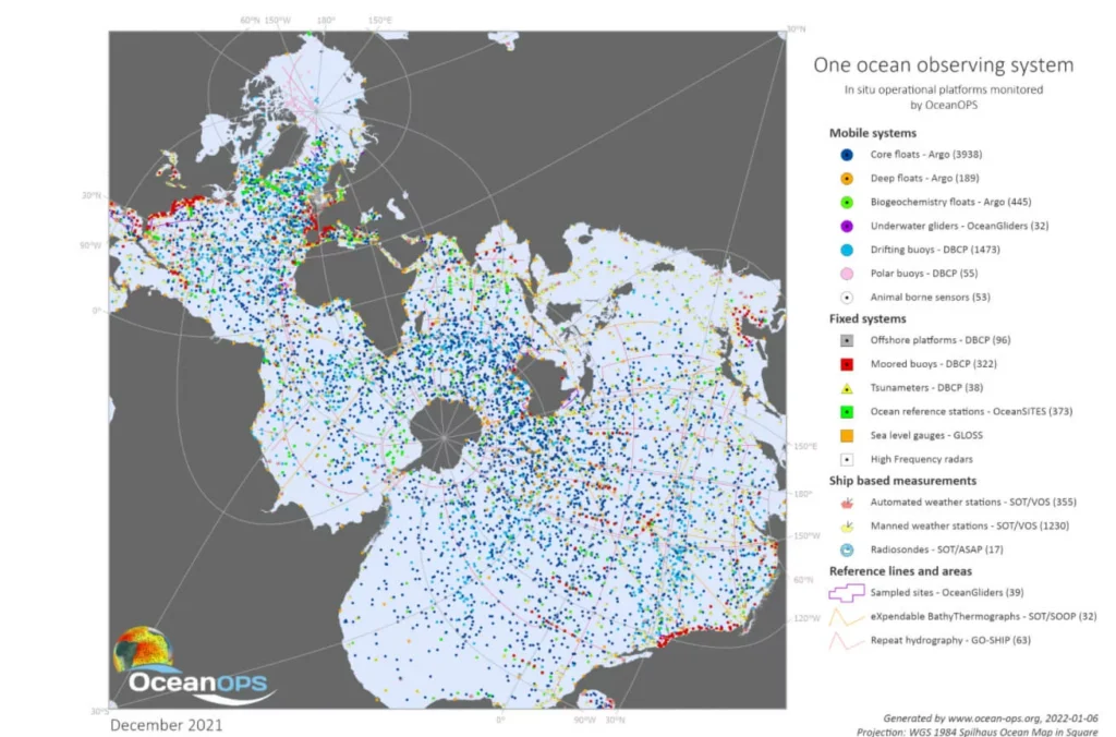
Recognizing the escalating threats to the ocean and its crucial role in sustaining the Earth, the UN declared 2021 to 2030 the United Nations Decade of Ocean Science for Sustainable Development (Ocean Decade). This ambitious plan aims to develop a better understanding of marine ecosystems, inform policy decisions, and promote sustainable management of the ocean. Esri, a leading technology company, is actively involved in several Ocean Decade programs and initiatives.
Esri’s participation in the Seabed 2030 project, a global initiative to map the entire ocean floor by 2030, is helping to expand the area of mapped seabed. Through partnerships and collaborations, Esri promotes the collection of bathymetric data and shares solutions for ocean mapping and data management. The company is also part of the Digital Twins of the Ocean (DITTO) program, which aims to create 3D digital ocean models using AI and specialized tools for marine data analysis.
In addition, Esri is involved in the Deep Ocean Observing Strategy (DOOS), an international organization coordinating the observation, exploration, and modeling of the deep ocean. By providing clear and engaging data visualizations through GIS, Esri helps tell the data stories and facilitates collaboration among scientists and policymakers. Esri’s commitment to ocean science and environmental protection extends to its work with the UN and other organizations, building the geospatial infrastructure necessary for addressing global challenges.
With its active involvement in various Ocean Decade programs, Esri demonstrates its dedication to scientific research, preservation of the ocean, and promoting sustainable practices. Through partnerships, technological advancements, and data-driven solutions, Esri continues to contribute to the understanding and protection of the ocean, ensuring a healthier
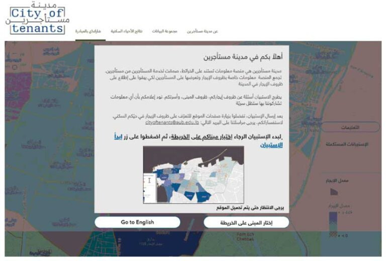
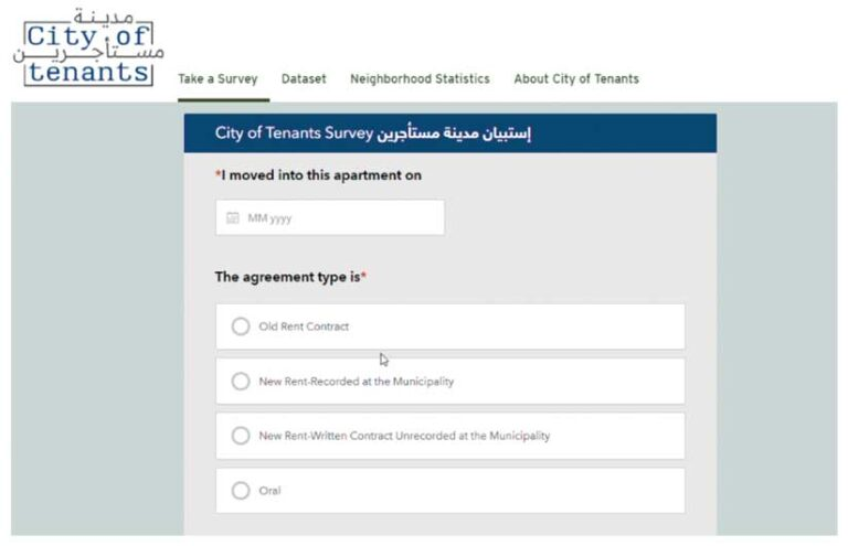
The Beirut Urban Lab, a university research lab in Lebanon, has created an online platform called the City of Tenants to address the lack of transparency in the rental housing market in Beirut. The platform utilizes GIS technology to map rental information contributed by tenants, providing access to data on rent prices and neighborhood characteristics. The database, called the Beirut Built Environment, includes detailed information about the city’s infrastructure.
Through ArcGIS Survey123 and ArcGIS Experience Builder, tenants can anonymously contribute data on rental conditions, such as occupancy status and housing costs. The collected data is used by researchers and policymakers to understand urban trends and develop responsive public policies. The platform aims to empower tenants by providing them with readily available rental market data, helping them make informed decisions and negotiate more effectively. The Beirut Urban Lab plans to expand the platform to other cities in Lebanon and automate data updates through ArcGIS Survey123.
A new era in publishing is on the horizon with the launch of GPT-4, the most advanced AI system created by OpenAI. This revolutionary technology is expected to transform various aspects of society, including academic publishing. However, the integration of AI in manuscript preparation and peer review raises ethical concerns that need to be addressed.
In academic publishing, peer review is a crucial process that ensures the quality and credibility of published work. With the advent of AI, the peer review process could become faster and less laborious, but it also raises concerns about the potential for identical reviews and the lack of field-specific critical input. To address this, journals could potentially ask reviewers to declare the extent to which AI generated the review.
The implications of AI for authors and academic institutions are also significant. The availability of software to create figures and text could make manuscript preparation faster and less labor-intensive, but it also raises questions of originality and ownership of creative work generated by AI. It is crucial for authors to remain vigilant and take steps to mitigate any potential bias. Transparency is key to addressing these issues, and it is essential to declare the involvement of AI in manuscript preparation.
The integration of AI-powered image analysis could enhance the process of assessing whether a submitted article is original, while also making the identification of suitable reviewers faster and more effective. These additional features would be a boon to busy academics who serve on editorial boards.
In conclusion, the advent of AI in publishing is a game-changer, but it needs to be balanced with ethical and transparent use. Editorial boards will need to make rapid decisions on how best to respond to ensure they act responsibly for authors, reviewers, and readers. The future of academic publishing is bright, but it will require careful consideration of the implications of AI for all stakeholders.
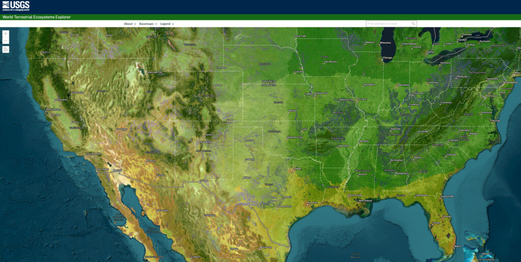
The US Geological Survey (USGS) partnered with Esri and The Nature Conservancy to release the World Terrestrial Ecosystems map, which divides the Earth based on similar climate, landform, and land cover rather than political boundaries.
According to Dr. Roger Sayre, senior scientist for ecosystems at USGS and lead on the project, knowing the location and classification of ecosystems is crucial for their management, as they provide goods and services such as food, water, and fuel.
The map is accessible through ArcGIS Living Atlas of the World and an explorer tool, and it can assist in conservation planning, analyzing ecosystem health and resilience, and achieving the Sustainable Development Goals (SDGs).
Additionally, in the Forrester New Wave: Climate Risk Analytics, Q4 2022 report, Esri received recognition as a leader in offering advanced data processing and visualization to help decision-makers address climate risks, receiving the highest score possible in 9 out of 10 criteria, including threat modeling, advanced data processing, and visualization.
Besides the acronym GPT for Generative Pre-Trained Transformer, this paper also refers separately to GPTs as “General-purpose technologies” such as the Steam Engine or Printing Press
LLMs will influence 49% of occupations by affecting half of their tasks – As AI progresses, it will increasingly automate and impact various aspects of your professional life. Jobs that are more white-collar will experience a more significant disruption.
LLMs will impact 10% of tasks in 80% of occupations – In the short term, the majority of individuals will experience AI affecting only a minimal part of their daily work.
The more challenging it is to enter a field, the more susceptible it is to LLMs – Fields like creative work and software engineering demand a certain level of understanding and effort to succeed, and AI is rapidly mimicking these abilities.
Notable quotes (emphasis mine):
“Concurrently, researchers have improved the steerability, reliability, and utility of these models using methods like fine-tuning and reinforcement learning with human feedback (Ouyang et al., 2022; Bai et al., 2022). These advancements enhance the models’ ability to discern user intent, rendering them more user-friendly and practical. Moreover, recent studies reveal the potential of LLMs to program and control other digital tools, such as APIs, search engines, and even other generative AI systems (Schick et al., 2023; Mialon et al., 2023; Chase, 2022). This enables seamless integration of individual components for better utility, performance, and generalization. In the long run, these trends suggest that LLMs may be capable of executing any task typically performed at a computer.”
Page 4 – 2.1 The Advancement of Large Language Models
“For the most part, generative AI models have predominantly been deployed as modular specialists, carrying out specific tasks, like generating images from captions or transcribing text from speech. However, we argue that it is essential to adopt a broader perspective, recognizing LLMs as crucial building blocks for additional tools. While constructing these tools and integrating them into comprehensive systems will take time and necessitate significant reconfiguration of existing processes across the economy, we already observe emerging adoption trends. Despite their limitations, LLMs are becoming increasingly integrated into specialized applications in areas such as writing assistance, coding, and legal research, paving the way for businesses and individuals to adopt GPTs more widely.”
Page 4 – 2.1 The Advancement of Large Language Models
“We emphasize the significance of these complementary technologies, partly because out-of-the-box general-purpose GPTs may continue to be unreliable for various tasks due to issues such as factual inaccuracies, inherent biases, privacy concerns, and disinformation risks (Abid et al., 2021; Schramowski et al., 2022; Goldstein et al., 2023; OpenAI, 2023a). However, specialized workflows—including tooling, software, or human-in-the-loop systems—can help address these shortcomings by incorporating domain-specific expertise.”
Page 4 – 2.1 The Advancement of Large Language Models
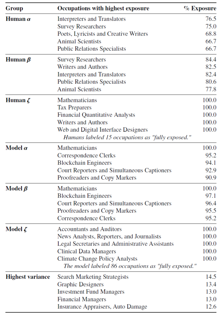
“Our findings suggest that, based on their task-level capabilities, GPTs have the potential to significantly affect a diverse range of occupations within the U.S. economy, demonstrating a key attribute of general-purpose technologies.”
Page 11 – 4 Results
“(table below)…As such, occupations listed in this table are those where we estimate that GPTs and GPT-powered software are able to save workers a significant amount of time completing a large share of their tasks, but it does not necessarily suggest that their tasks can be fully automated by these technologies.”
Page 15 – Table 4
Page 15 – Table 4
“Moreover, the adoption of LLMs will vary across different economic sectors due to factors such as data availability, regulatory quality, innovation culture, and the distribution of power and interests. Consequently, a comprehensive understanding of the adoption and of large language models by workers and firms requires a more in-depth exploration of these intricacies.”
Page 21 – 6.1 GPTs as a General-Purpose Technology
As generative AI advances swiftly and attracts significant investments, challenges loom on the horizon for organizations, institutions, and businesses dealing with the repercussions across global workforces. Established organizations with extensive governance, technical, security, regulatory, and other pertinent business documentation appear poised to capitalize on innovative findings derived from Large Language Models’ ability to synthesize seemingly unrelated information. Likewise, organizations with well-documented automated business processes may be able to efficiently integrate the latest capabilities offered by Large Language Models such as GPT-4.