
This Esri satellite map was built using the JavaScript API for ArcGIS the latest version of which allows you to build full-featured 3D applications powered by web scenes that can include rich information layers such as terrain, basemaps, imagery, features, and 3D objects. Ask us how we can empower your business, organization, or non-profit with spatial visualization.
This image and link below depicts the location of approximately 1,250 Low Earth Orbit, Medium Earth Orbit, and geosynchronous orbit satellites. If you click on one of them it will show you its orbit as well as its 24-hour trajectory shadow.
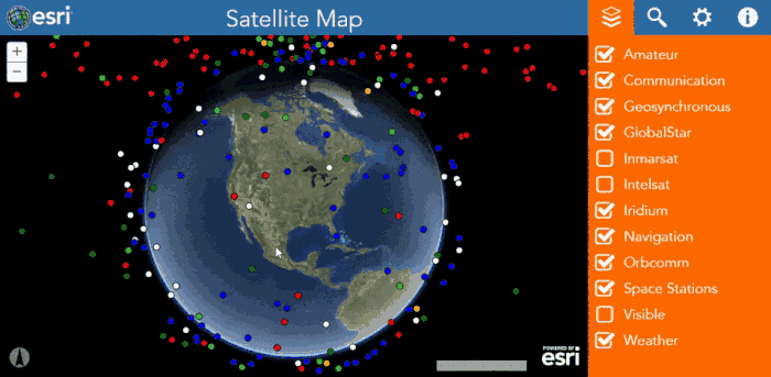
All satellite data provided by Space-Track.org, an organization that promotes space flight safety, protection of the space environment and the peaceful use of space worldwide by sharing space situational awareness services and information with U.S. and international satellite owners/operators, academia and other entities.